Log in
All resources
Create a design
33,512 Free Images of 1576 Maps
maps in the library of congress
details of old maps
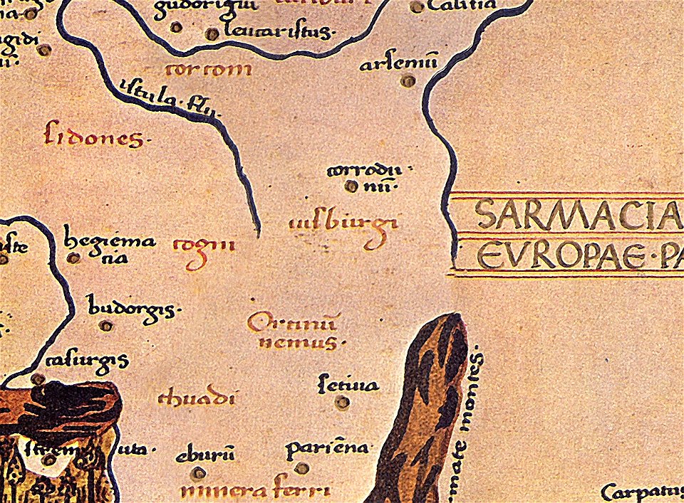
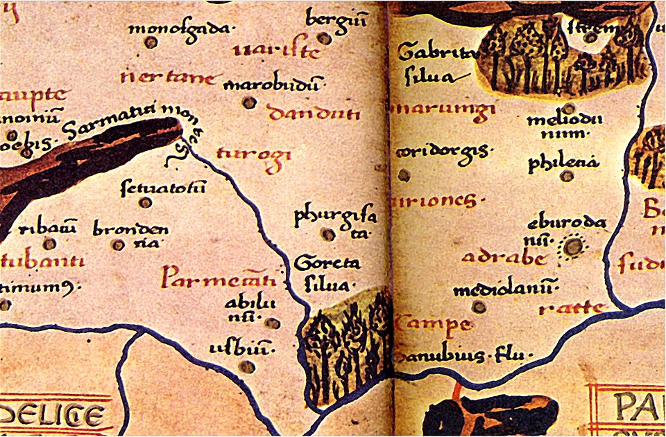
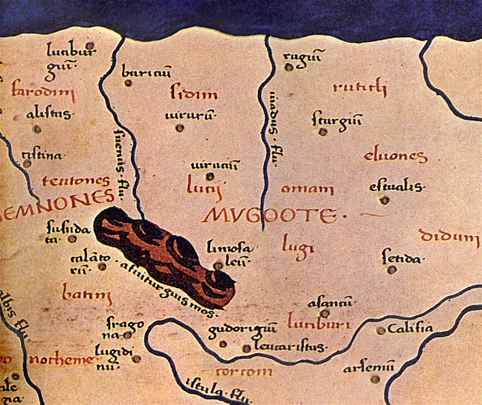
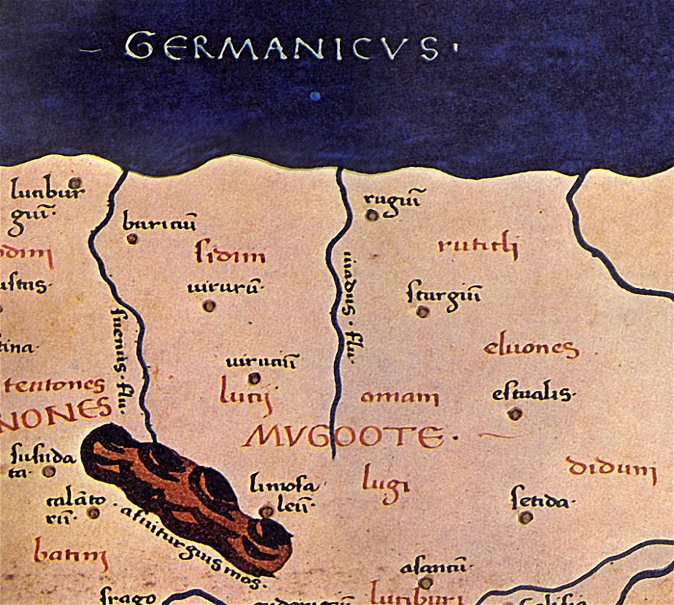
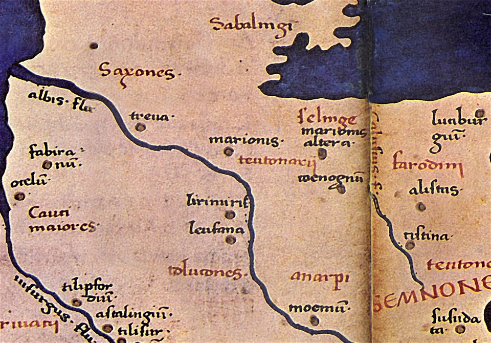
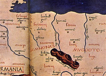
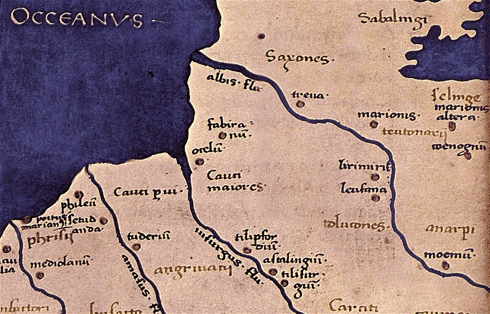
maps of germania magna
donnus nicolaus germanus
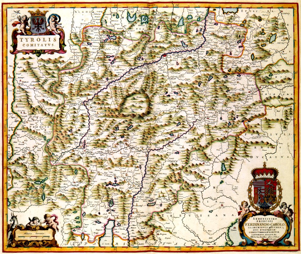
maps with cartouches
atlas van der hagen
maps by royal bavarian land tax commission
old maps of freising
atlas van der hagen (volume 1)
town maps by l. r. burleigh
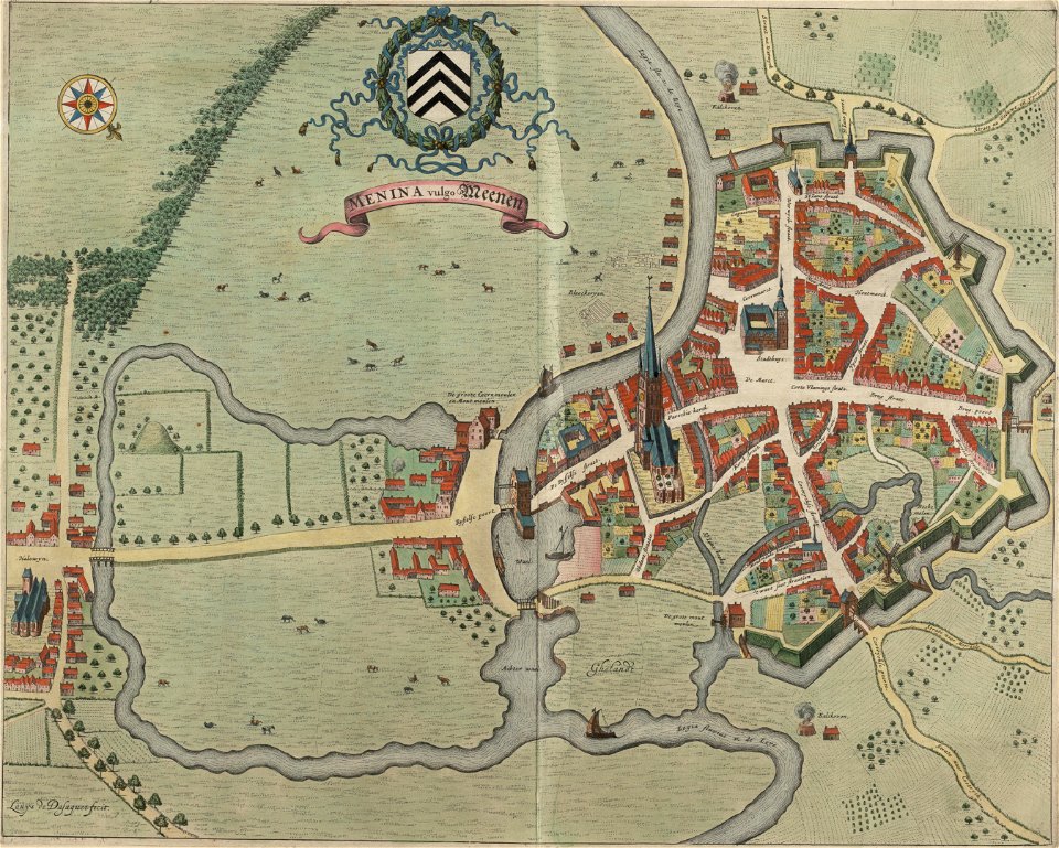
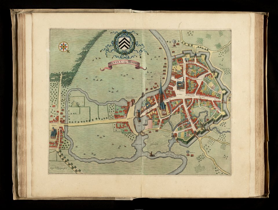
flandria illustrata
old maps of menen
flandria illustrata
old maps of menen
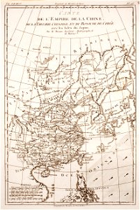
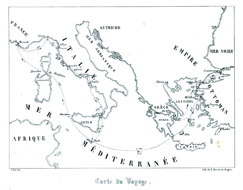
maps showing 18th-century history
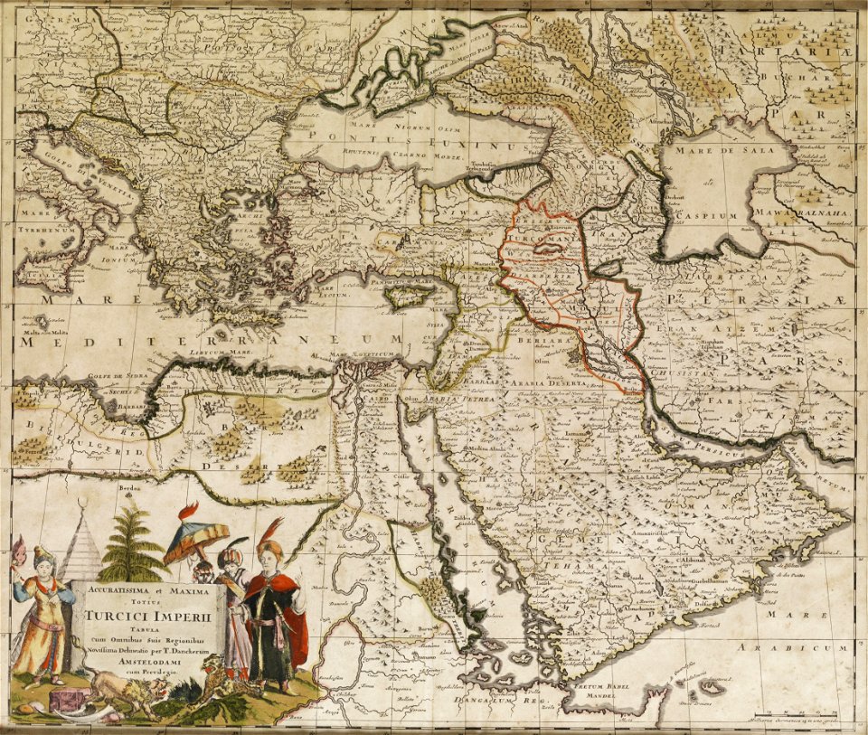
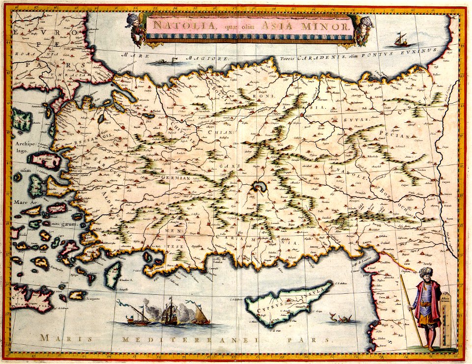
old maps of the ottoman empire
maps of germania magna
details of old maps
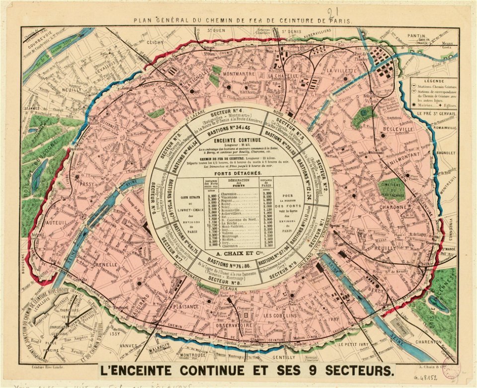
maps of paris from paris musées
rail transport maps of paris
old maps of venice
johannes ratelband
maps of germania magna
details of old maps
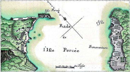
île bonaventure
percé
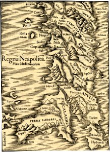
maps of the kingdom of naples
maps in the british museum
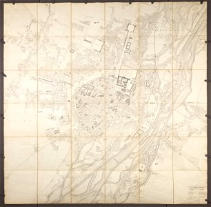
old city maps of munich
munich in the 1830s
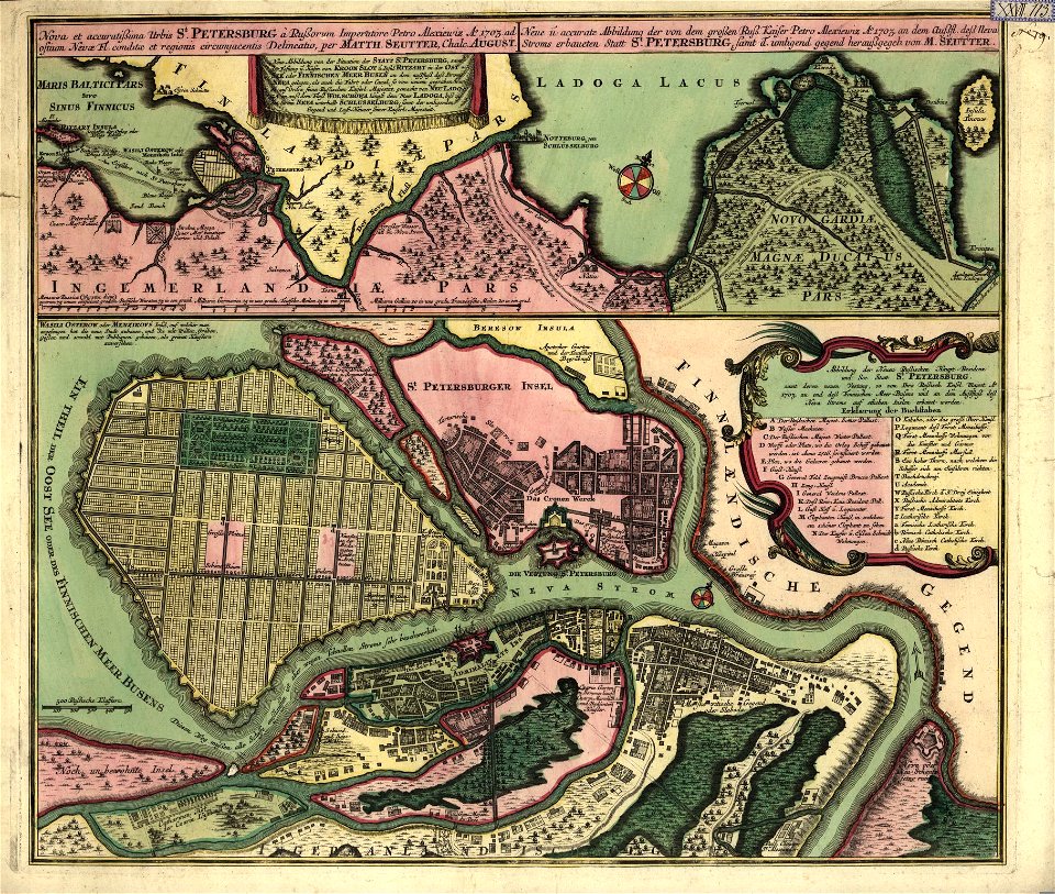
18th-century maps of saint petersburg
matthäus seutter
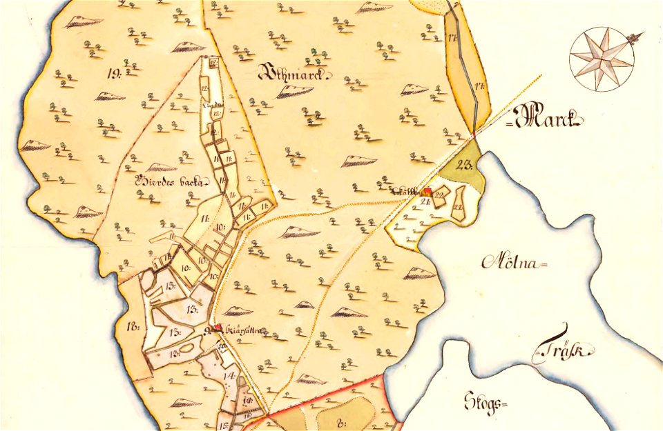
maps of lidingö
skärsätra gård
maps in the library of congress
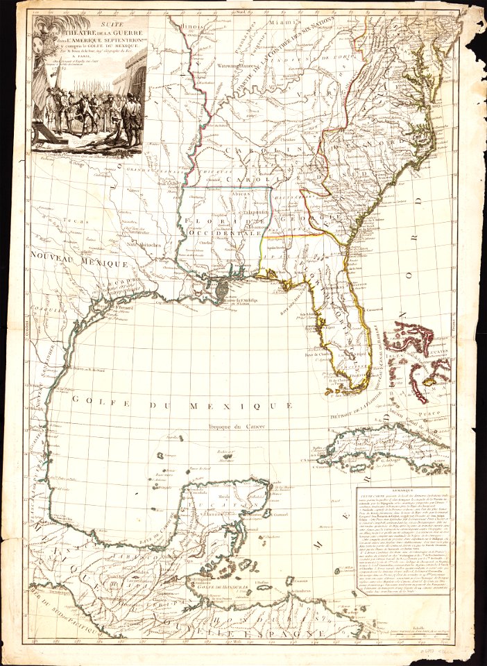
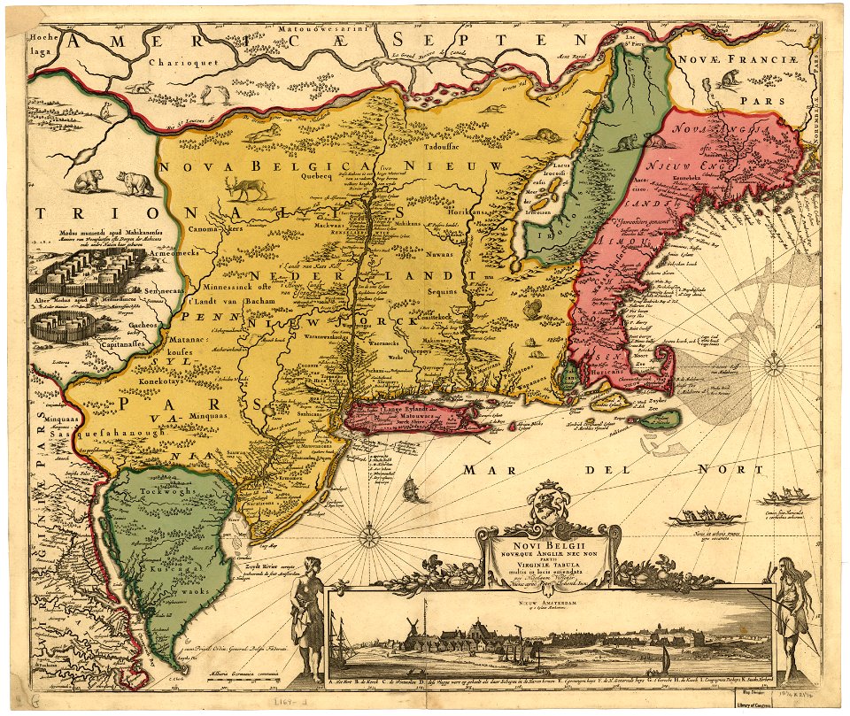
1782 maps of north america
maps in the library of congress
1782 maps of north america
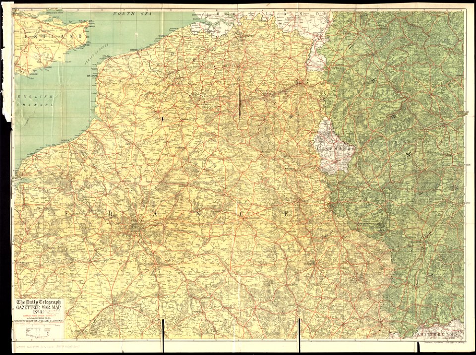
maps of world war i by the daily telegraph
1915 maps
maps of germania magna
details of old maps
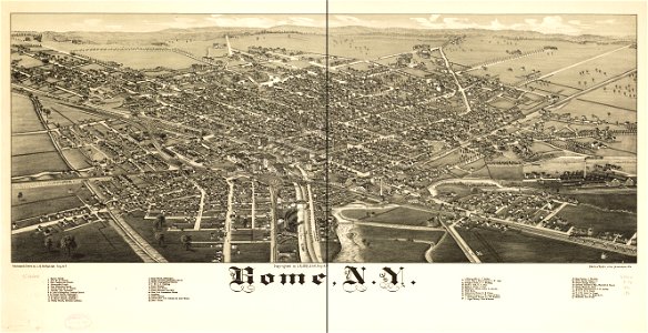
new york
rome
old maps of oudenaarde
flandria illustrata
maps of germania magna
details of old maps
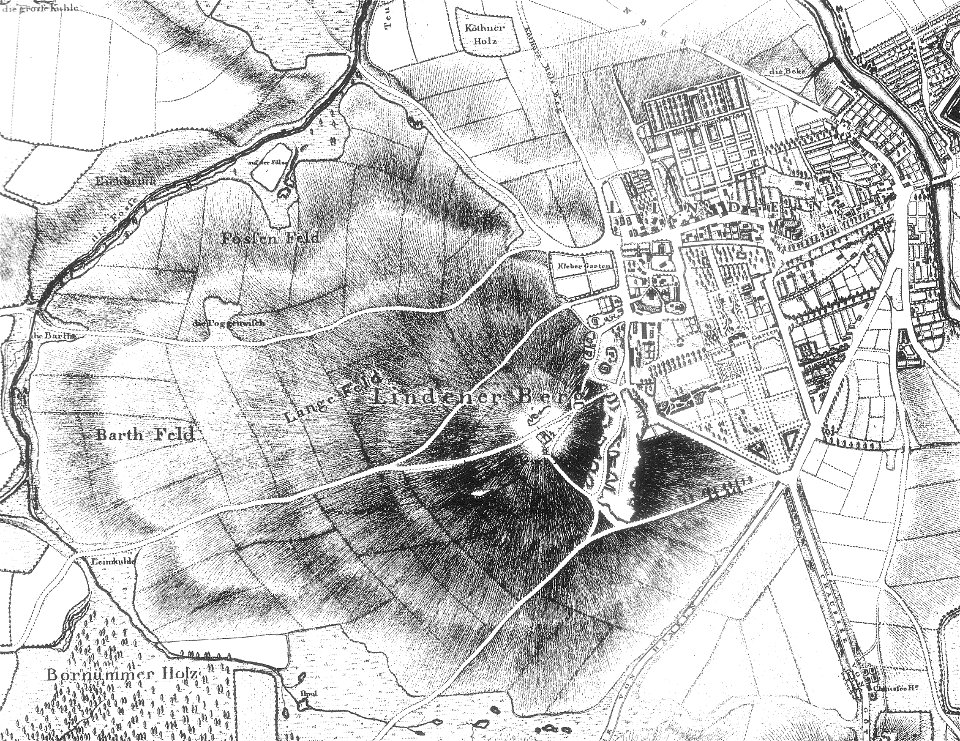
maps of linden (hannover)
old maps of hannover
maps of germania magna
details of old maps
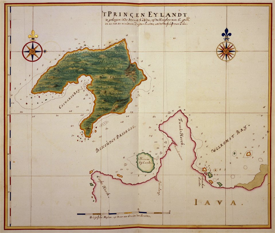
17th-century maps of indonesia
johannes vingboons
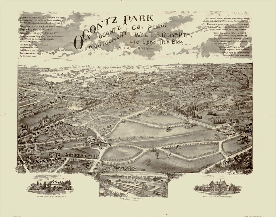
o. h. bailey
1880 maps
o. h. bailey
1880 maps
isolario di benedetto bordone (1547)
maps by benedetto bordon
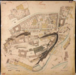
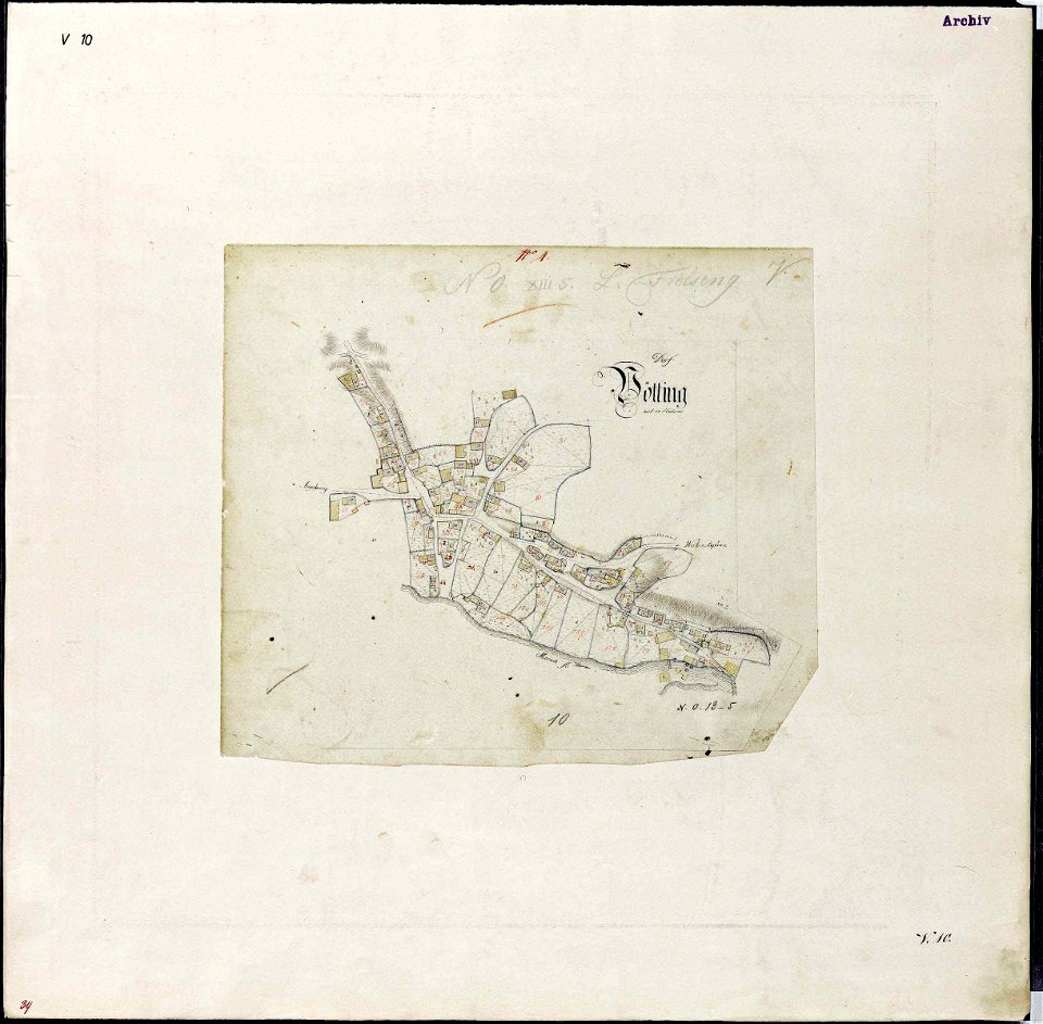
maps by royal bavarian land tax commission
old maps of freising
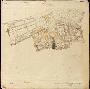
maps by royal bavarian land tax commission
old maps of freising
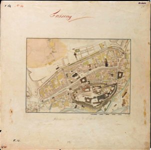
maps by royal bavarian land tax commission
old maps of freising
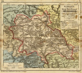
19th-century maps of baden-württemberg
history of weinsberg
maps by royal bavarian land tax commission
old maps of freising
maps of germania magna
details of old maps
engravings by matthäus merian
1649 maps
maps by royal bavarian land tax commission
old maps of freising
maps by royal bavarian land tax commission
old maps of freising
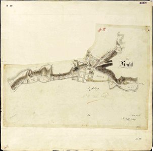
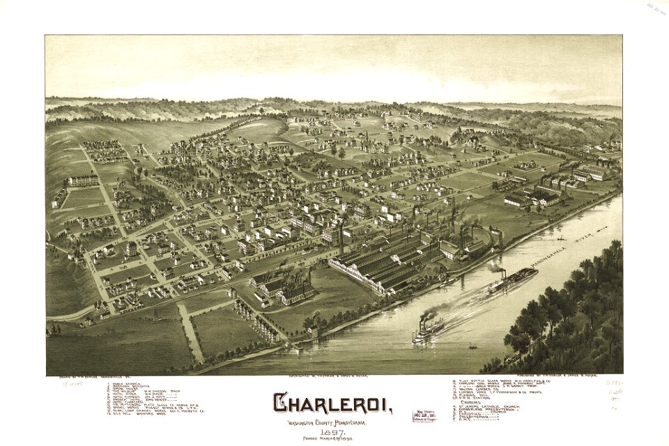
maps in the library of congress
charleroi historic district
maps in the library of congress
charleroi historic district
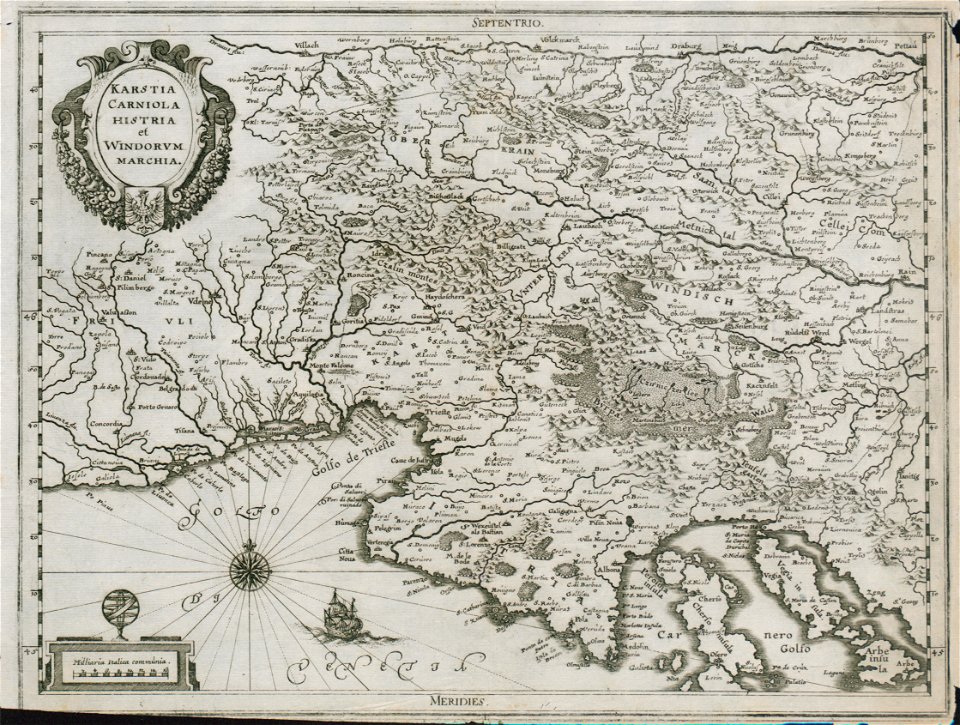
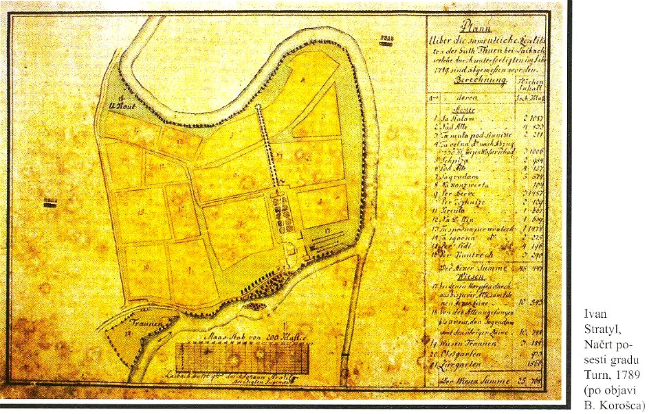
18th-century maps of slovenia
kodeljevo park
maps of germania magna
details of old maps
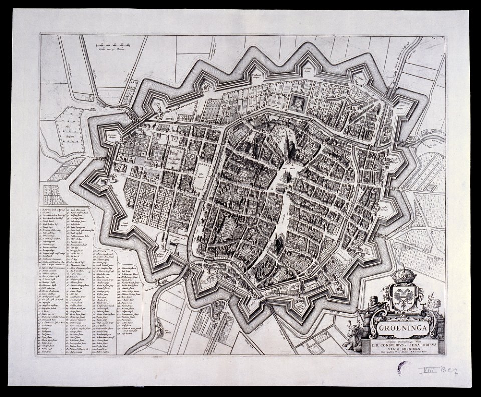
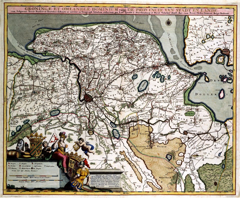
maps by willem and johannes blaeu
old maps of groningen (city)
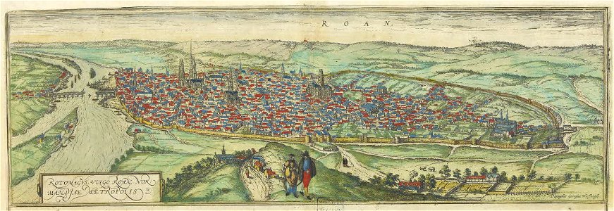
maps and topographical views by joris hoefnagel
old maps of rouen
maps of germania magna
details of old maps
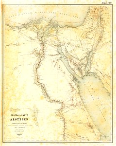
lepsius-projekt - maps
egypt in the 1850s
itinerarium hierosolymitanum et syriacum..., 1619
ships on maps
maps of the canton of basel-landschaft
old maps of switzerland
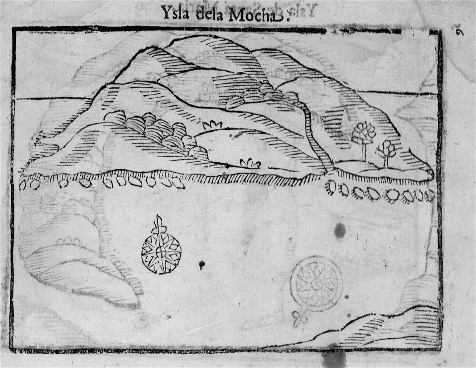
old maps of chile
alonso de ovalle
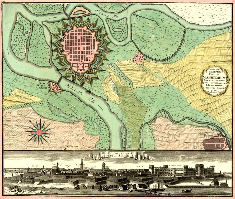
johann baptist homann
festung mannheim
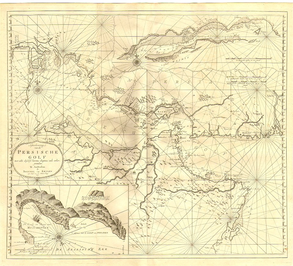
johannes van keulen
1753 maps
maps of germania magna
details of old maps
dutch-language maps
atlas van loon
braun & hogenberg
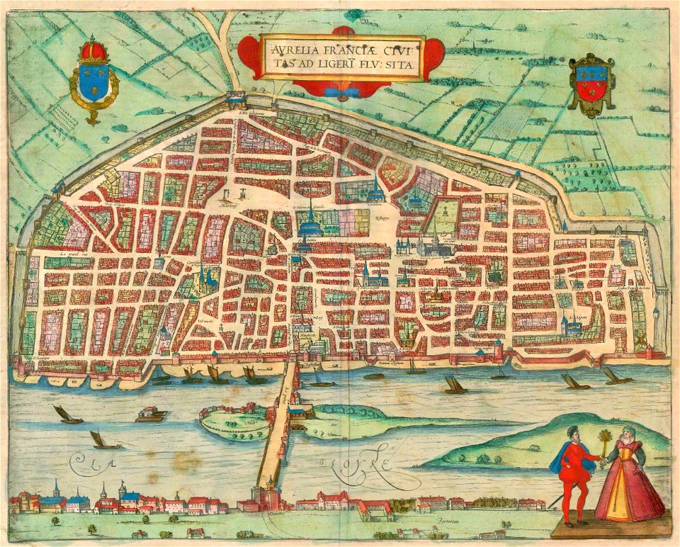
orléans
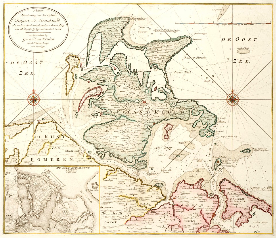
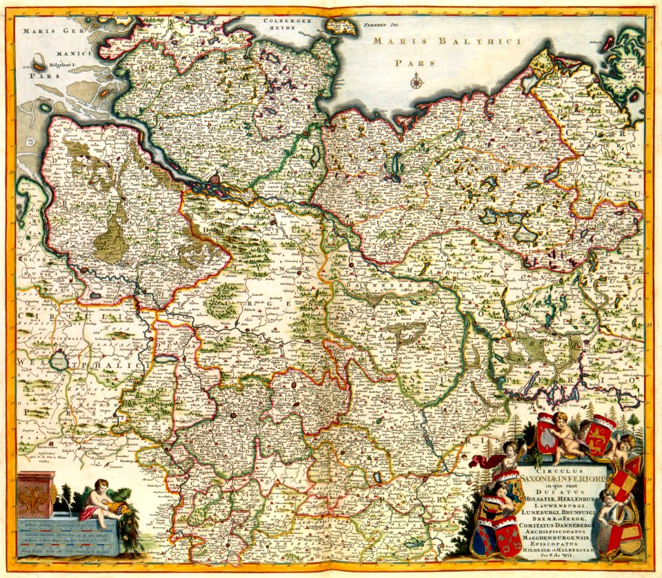
old maps of mecklenburg-vorpommern
gerard van keulen
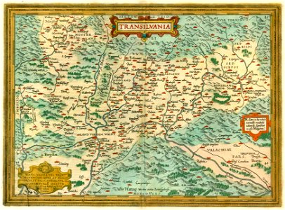
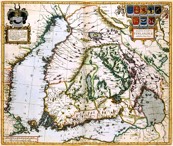
1612 maps of transylvania
maps by abraham ortelius
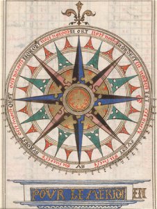
compass roses on maps
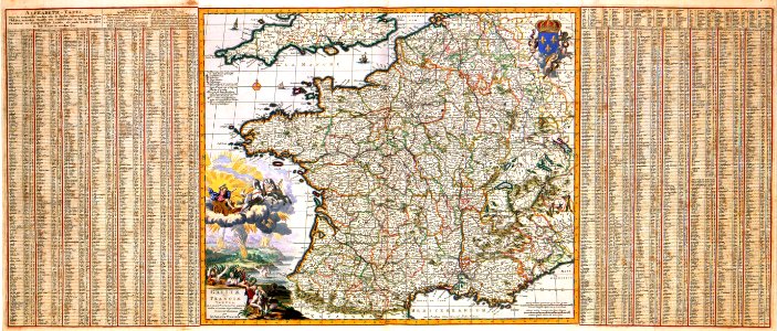
almanacs of france
copper engraving
beavers in art
coats of arms of the crown of aragon
coats of arms on maps
18th-century maps of japan
1780 in japan
maps made in the 18th century
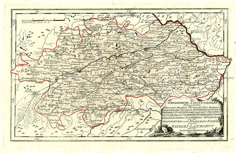
maps of lower bavaria
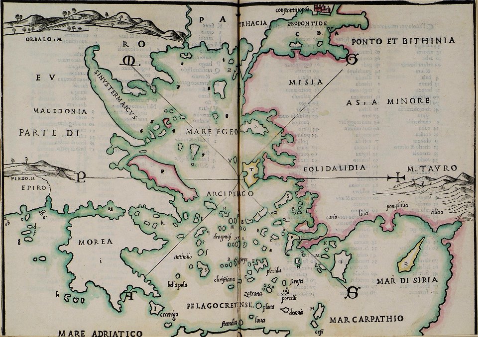
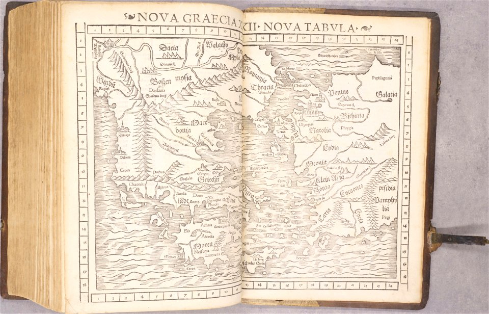
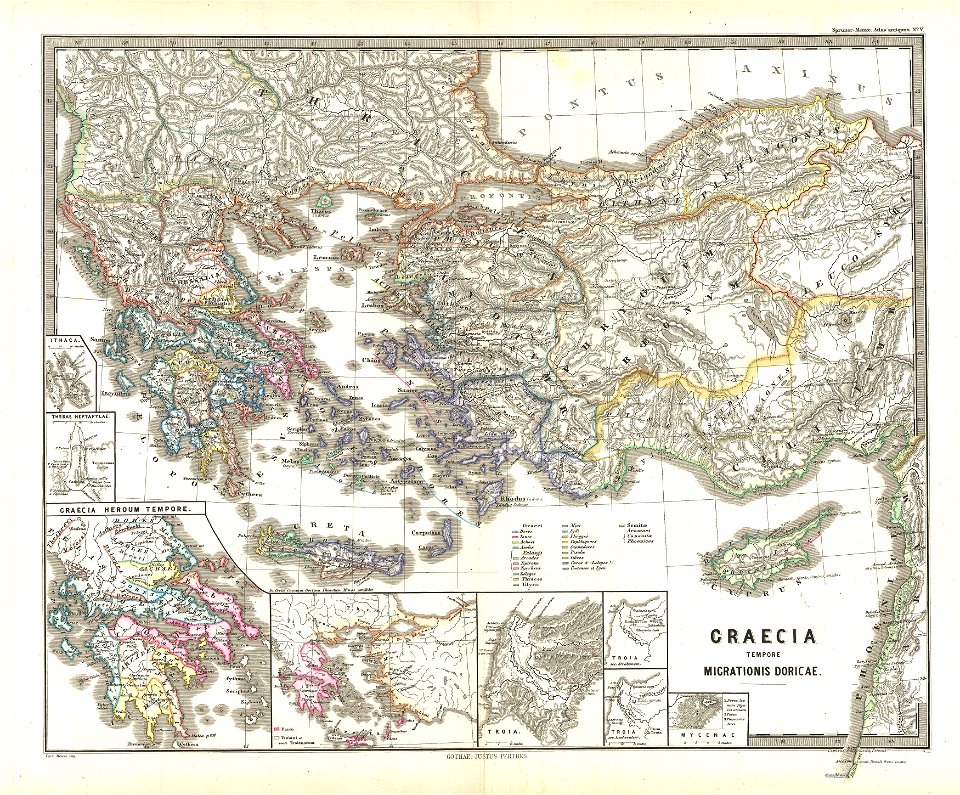
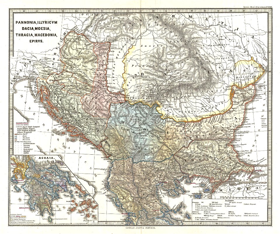
old maps of greece
1552
old maps of greece
old maps of italy
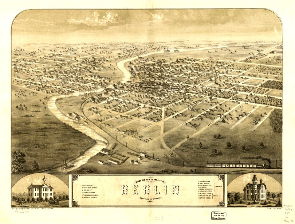
wisconsin
berlin
maps in the library of congress
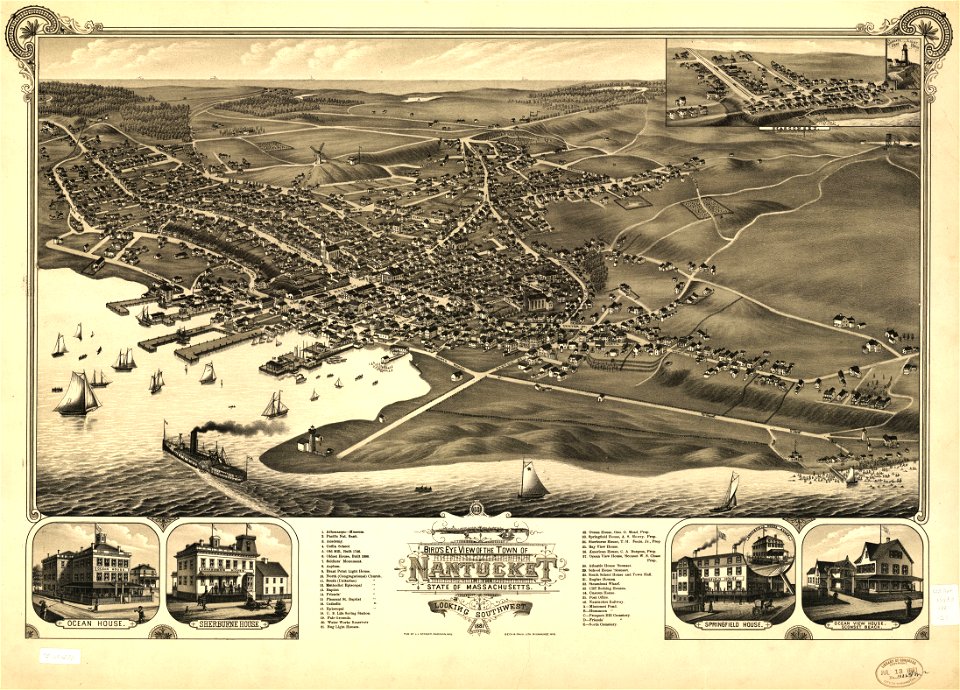
massachusetts
maps in the library of congress
massachusetts
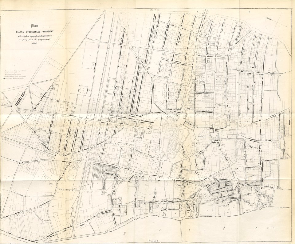
historical maps of warsaw
1862 maps
karl spruner von merz
1865 maps
karl spruner von merz
1865 maps
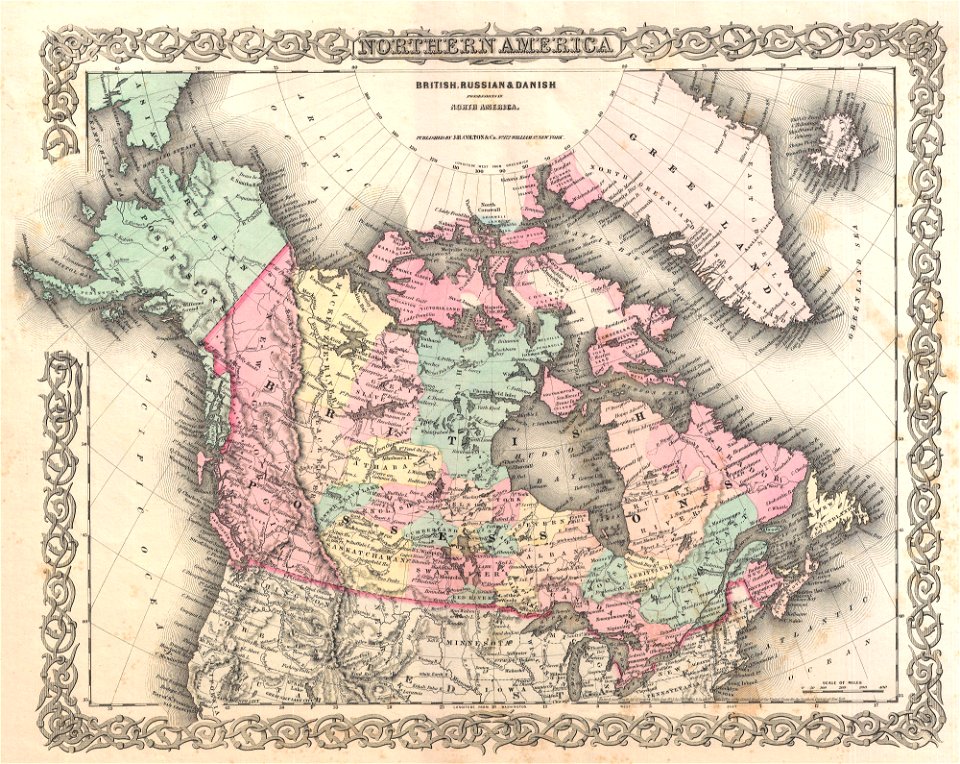
old maps of canada
province of canada
hampton roads history
old maps of virginia
atlantis magni tomus primus (biblioteca comunale di trento)
maps by pieter schenk (i)
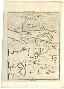
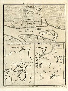
old maps of guangzhou
1745
old maps of guangzhou
1745
maps of the west-indische compagnie
1665
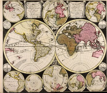
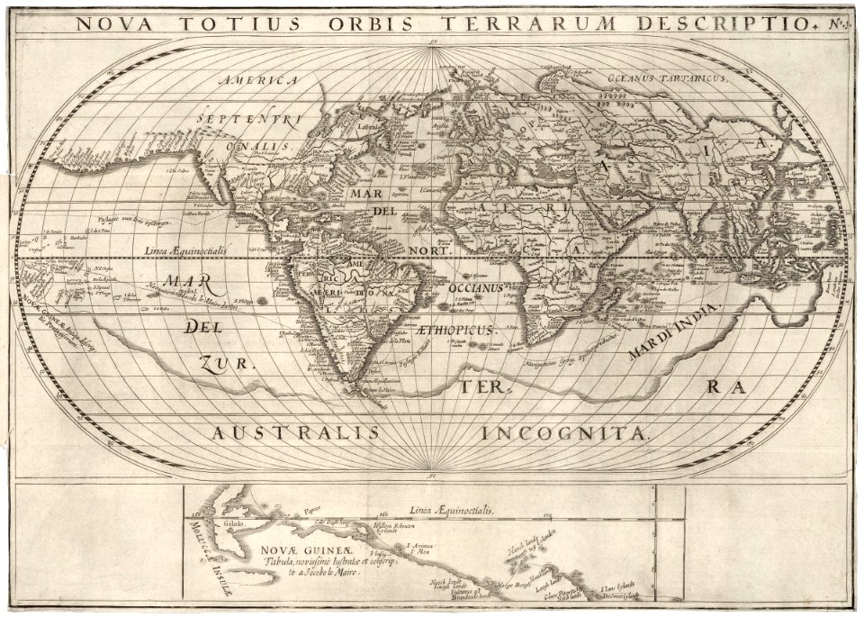
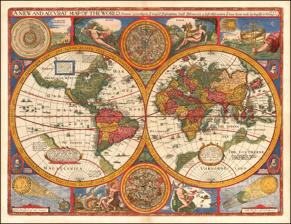
1620s maps of the world
1621 maps
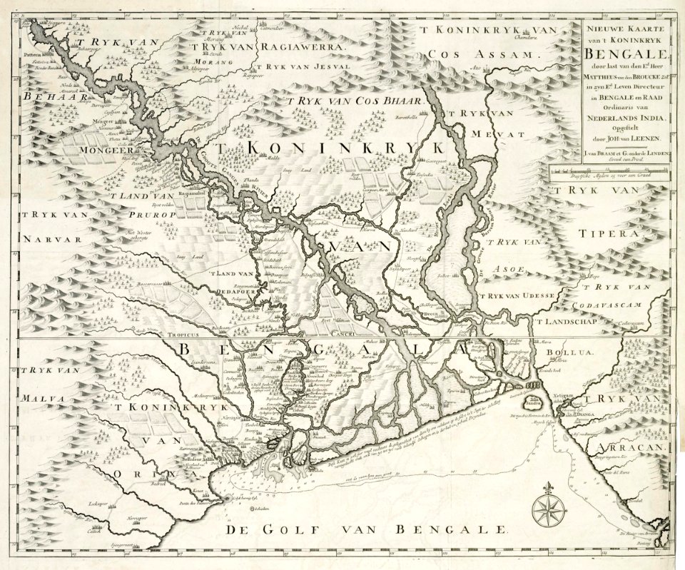
dutch bengal
1726 maps
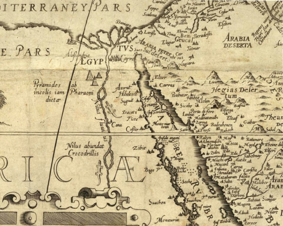
harbours in egypt
sieabo
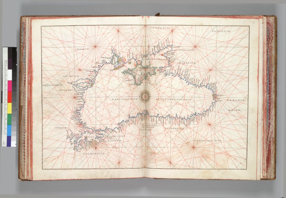
16th-century maps of the black sea
battista agnese
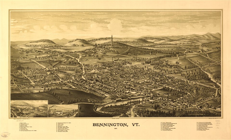
maps in the library of congress
vermont
maps in the library of congress
vermont
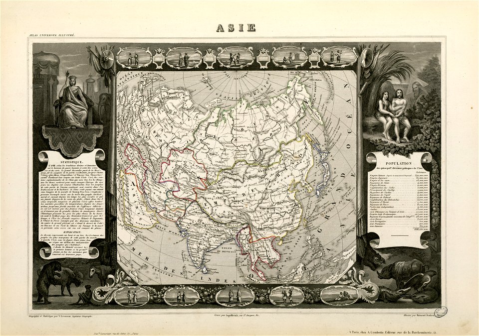
victor levasseur - maps of the world
old maps of asia
maps with cartouches
atlas van der hagen
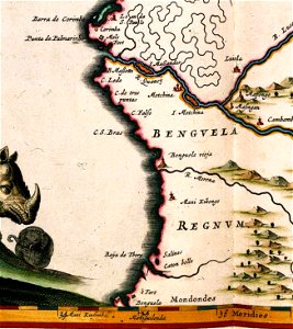
benguela
luanda
maps with cartouches
copper engraving
maps with cartouches
atlas van der hagen
maps with cartouches
atlas van der hagen
maps with cartouches
atlas van der hagen
old maps of groningen (province)
maps with cartouches
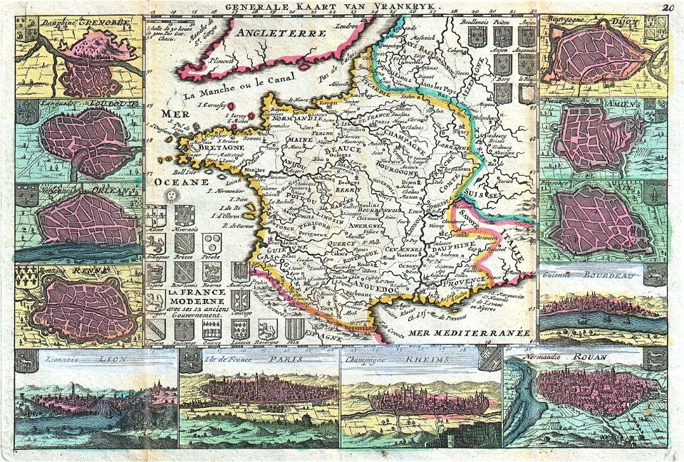
17th-century maps of france
maps with cartouches
maps with cartouches
old maps of turkey
french-language maps
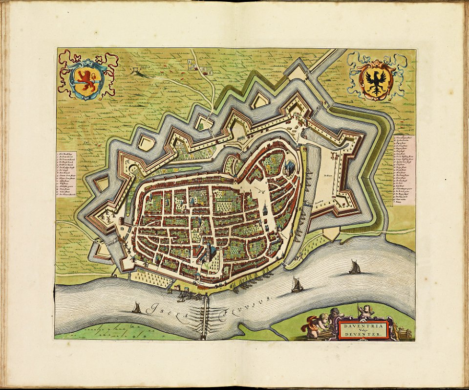
johannes ratelband
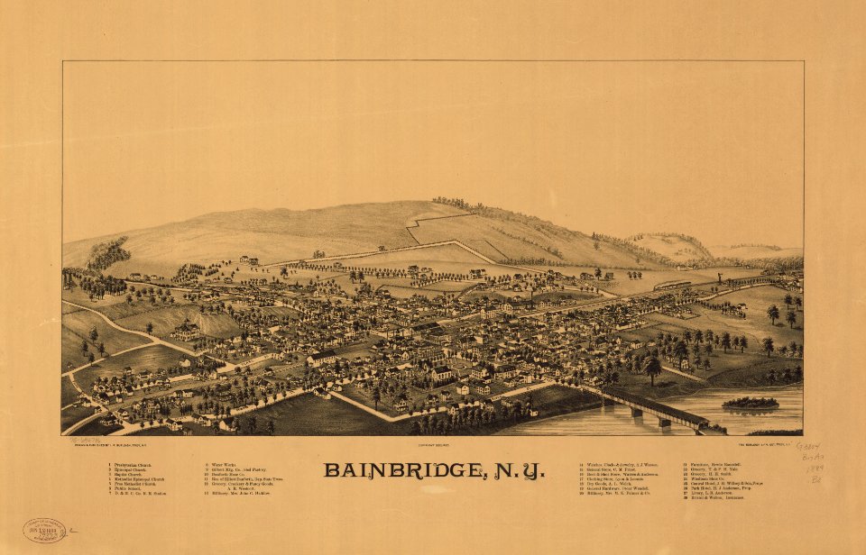
bainbridge
new york
17th-century fortress plans
coats of arms on maps
latin-language maps
johannes ratelband
allegories of the four elements
islands of california
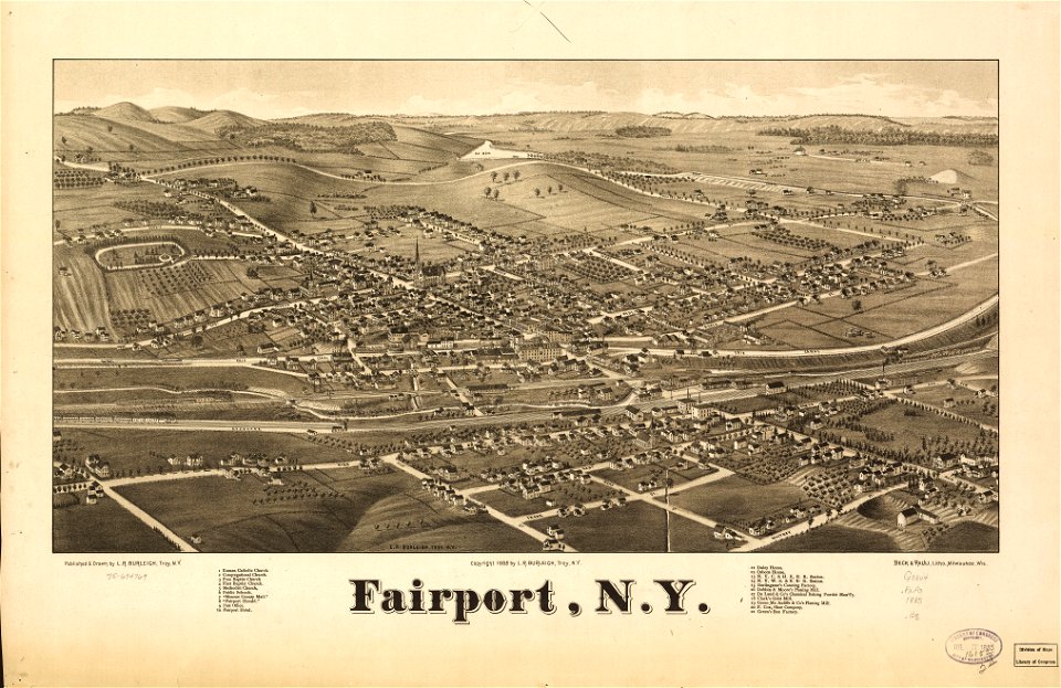
new york
fairport
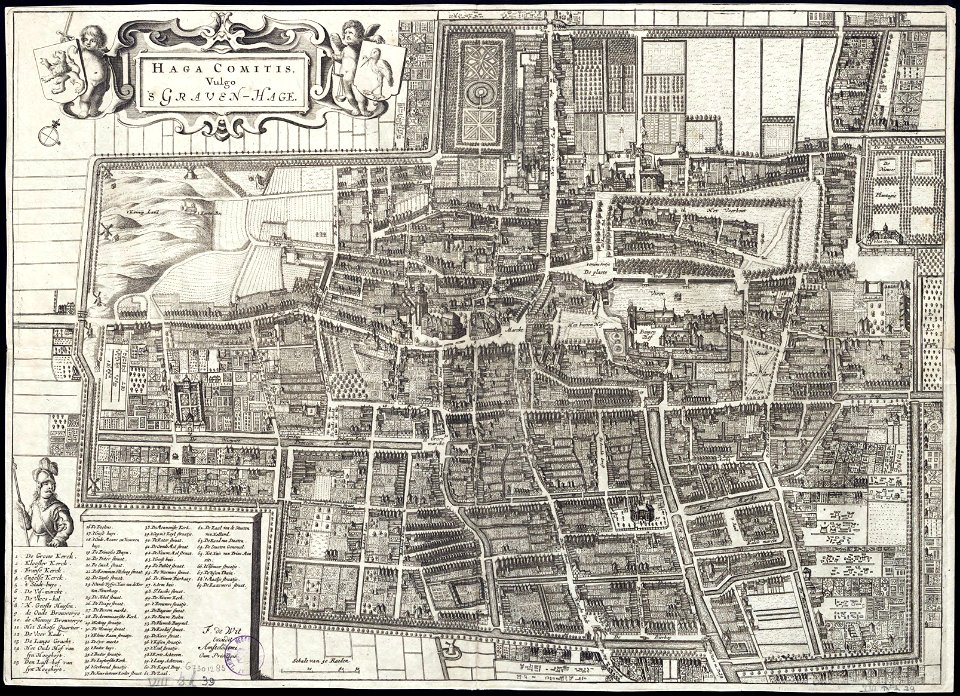
maps by frederick de wit
old maps of the hague
maps of paris in the 1840s
1843 in paris
19th-century maps of japan
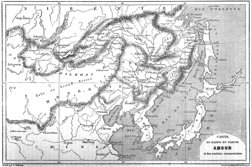
old maps of manchuria
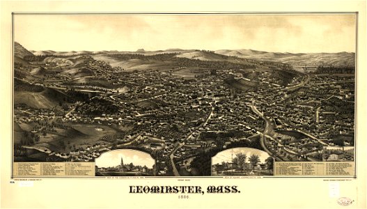
massachusetts
leominster
1860s maps of the united states
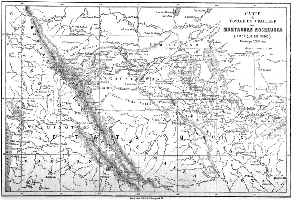
maps by alexandre vuillemin
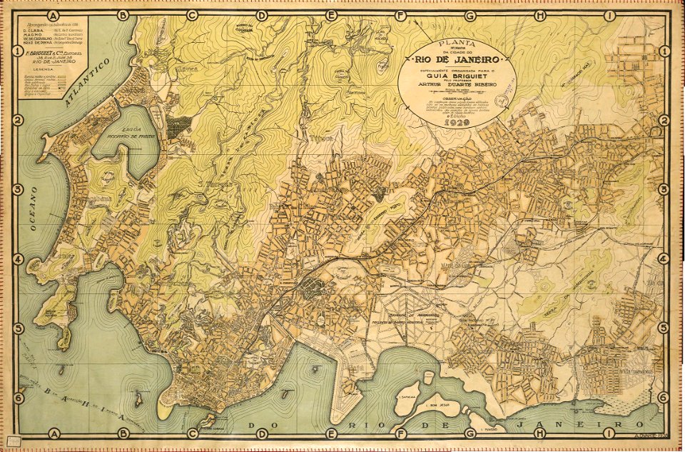
rail transport maps of brazil
20th-century maps of brazil
dancker danckerts
joan blaeu
3301 - 3400 of 33,512
Next page
/ 336